Illumination Cartography
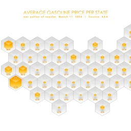
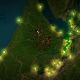
Here are a few flavors of a technique, illumination cartography, that uses data to shed light on its underlying basemap. There’s something satisfying about presenting a phenomenon as revealing geography rather than obscuring it. 0:00 Illuminating intro0:06 Adding some lighthouses from ArcGIS Online0:16 Firefly point symbology0:49 Darkening the underlying imagery basemap with Effects1:11 Illuminating with … Continue reading Illumination Cartography